Showing posts with label gunung ayam. Show all posts

Saturday, 12 April 2008

Baha’s camp, Kelantan


Date: 12 Apr 2008 - 13 Apr 2008 [2D/1N]
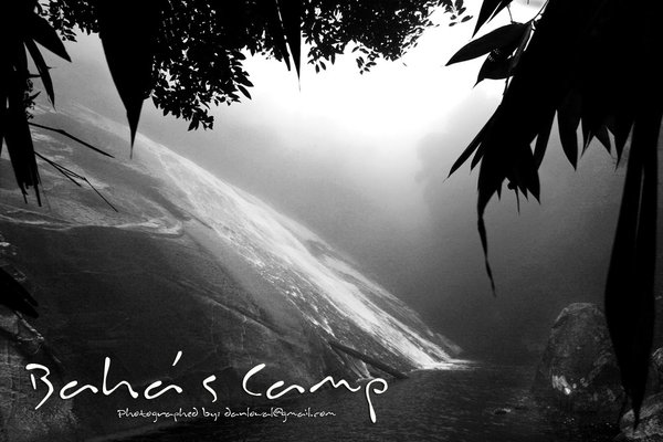
Location: Baha’s camp, Kelantan / Jelawang Waterfall
Altitude: 450-550m ASL
Difficulty: 1.5/10 (http://danlow.multiply.com/journal/item/50)
Camera: Canon EOS 350D
Lens: Tokina AT-X 124 AF Pro DX 12-24mm f/4
Filter: none
Post editing: PS CS3
Organizer: Dan
Members: Winnie, Shoan, Doreen, Rockson, Kah Fai, KL Tan, Jac, Lucy, CS Law and Khai Chern.

The day has come for humans to walk the tallest waterfall(Jelawang) in South East Asia again…. :P

This is my 3rd time there ... but this time is just purely Baha's camp, no Gunung Stong, no Gunung Ayam. .... 

My reason to go there: Bring my friends there

Journey 
12 Apr, 2008
0930 Left Butterworth
1130 Lunch Break at Puncak Titiwangsa
1400 At Mt Stong State Park Entrance
1420 Gear Up and Start Hike
1540 At BAHA campsite
1600 Set up tent and shower 
1730 Prepared dinner
1930 Dinner & chit-chat
2130 Celebrate Kah Fai's Birthday
2200 Star watching
2330 zzzZZZZZZZ

13 Apr, 2008
0645 Wake up call
0640 Sunrise watch
0745 Prepare simple breakfast
1000 Head for Telaga Tujuh and Y Waterfalls
XXX Back to camp site
XXX Hike down to car park and clean up
XXX Tea break at Puncak Titiwangsa
0800 Dinner at Grik
1030 Home
Y waterfall is where Gunung Stong and Gunung Ayam meets. About 30 min walk from Baha’s camp.

Cost 
- Guide Fees: NIL
- 4WD: NIL
- Entrance fees: RM3/pax
- Camp site fees: RM3/pax
- Food: RM18.00
- Transport: Passangers AA share petrol + tol cost - Drivers don't pay
Rewards of this trip 
- All of us in O2P could camp togather, that's the most important thing
- Easy and short trail, so all of us could go
- Nice campsite
- Nice waterfalls
- Nice sunrise view
Challenges of this trip 
- This place has been declared "Gunung Stong State Park", that means entries are controlled. You will be forced to take a guide, it will cost RM90/day if I'm not wrong. Well I argued that we have been there several times, and is a very short trail like and evening hike up to Bukit Mertajam, so we escaped the extortion this time.


Monday, 3 July 2006

Gunung Ayam 1,504m


Date: 03 Jun 06 - 04 Jun 06
Location: Gunung Ayam, Kelantan
From: Mount Stong State Park, Dabong, Kelantan
Altitude: 1,504m ASL
Difficulty: 6.5/10 (http://danlow.multiply.com/journal/item/50)
Hike duration: 2D/1N
Camera: Canon EOS 350D
Lens: Sigma 18-200mm F3.5-6.3 DC
Filter: Hoya CPL
Post editing: PS CS2
Organizer: Kenny Sin(AH) - they were also there, so we trailed them
Members: Dan, Lucy, Ewe Cheong, Kah Fai and KL Tan
Guide: NIL
Reason of my visit: Heard it is nice up there, wanted to try hiking with full load

Gunung Ayam 1,504m is located in Kelantan, 5 hours drive from Butterworth, Penang. 
From Grik to Jeli then to the base of Jelawang waterfall is where we started the hike up to this very beautiful mountain. It takes approximately 1-2 hours to hike from the park entrance to Baha’s camp (the base camp) and another 5-6 hours to the summit of Gunung Ayam. We camped at the false peak and visit the summit the next morning.

Most of the trekkers will set their base camp at the top of Jelawang waterfall to have a easy journey. The junction to G.Ayam 1,504m & G.Stong 1,433m at one hour distance after the Base camp. The trek to Gunung Ayam is more challenging and arduous than Gunung Stong trek because take about 3 hour to the summit of Gunung Stong but 6 hour to the top of Gunung Ayam.

These pictures were taken at Gunung Ayam Kelantan during my hiking trip there. Gunung Ayam has these very unique Ferns(蕨类植物的叶子) growing near the summit region, I have not seen these type of fern else where so far...