Sunday, 18 May 2008

Bukit Tabur 450m 2008

Date: 18 May 2008 - 19 May 2008 [2D/1N]
Location: Bukit Tabur, Melawati, Selangor
Altitude: 450m ASL
Difficulty: 1.5/10 (http://danlow.multiply.com/journal/item/50)
Camera: Canon EOS 350D
Lens: Tokina AT-X 124 AF Pro DX 12-24mm f/4 [for all wide angle shots]
Lens: Sigma 18-200mm F3.5-6.3 DC [for tele shots and night shots]
Filter: none
Post editing: Adobe Photoshop Lightroom 2.0
Post editing: Adobe Photoshop CS3
Guide: Lilian
Members: Dan, KL, EC, Judy, CS and Khai Chern
My reason to go there: Wanna take sunset and sunrise shots + wanna camp there for a night.
Remark: Kuala Lumpur cityscape was taken from Bukit Tabur at night.


SLIDESHOW


Saturday, 26 April 2008

Bunaken Island, Sulawesi

Date: 26 Apr 08 - 27 Apr 08 [2D/1N]
Location: Bunaken Island, Sulawesi, Indonesia
No. of dives: 3

Accessibility to dive sites: 8.5
Marine Animal Density: 7.5
Dive site terrain Quality: 9.0
Marine Animal Diversity: 7.7
Visibility: 8.5
Overall Score: 8.2

Entry: Boat
Difficulty: OW-AOW
Dive Sites: Walls/Fringing reefs

Camera: Canon Powershot A80
Underwater casing: Canon Waterproof Case WP-DC900 for Powershot A80 by Canon
Strobe: NIL
Oraganizer: Dan
Members: Lilian, Sam, KL Tan, Choon Wai, Kok Leong, CS Law, Doreen, Lucy and Kiki


Remark: We were there for only 2 days, we did just 3 dives before leaving for Lembeh Island on the other side(East) of North Sulawesi. Wall diving is the main attraction of Bunaken with many vertical cracks and canyons. Reef top sheltered from waves, with many differently shaped hard corals. I find diving at Bunaken pleasant. However our main purpose there was Lembeh straits, so without wasting to much time there, we headed for Lembeh Straits on the afternoon of day 2.
From Wikipedia, the free encyclopedia
Bunaken is part of the Bunaken National Marine Park, which has some of the highest levels of marine biodiversity in the world. Scuba diving attracts many visitors to the island. Bunaken is located at the north of the island of Sulawesi, Indonesia. It belongs administratively to the municipality of Manado.

The Bunaken National Marine Park was formally established in 1991 and is among the first of Indonesia's growing system of marine parks. The park covers a total surface area of 890.65 km², 97% of which is overlain by sparkling clear, warm tropical water. The remaining 3% of the park is terrestrial, including the five islands of Bunaken, Manado Tua, Mantehage, Nain and Siladen. Although each of these islands has a special character, it is the aquatic ecosystem that attracts most naturalists.
The waters of Bunaken National Marine Park are extremely deep (1566 m in Manado Bay), clear (up to 35-40 m visibility), refreshing in temperature (27 to 29 °C) Pick any of group of interest - corals, fish, echinoderms or sponges - and the number of families, genera or species is bound to be astonishingly high. For example, 7 of the 8 species of giant clams that occur in the world, occur in Bunaken. The park has around 70 genera of corals; compare this to a mere 10 in Hawaii. Although the exact number of fish species is unknown, it may be slightly higher than in the Philippines, where 2,500 species, or nearly 70% of all fish species known to the Indo-western Pacific, are found.

Other sides of Bunaken.Oceanic currents may explain, in part, why Bunaken National Marine Park is such a treasure trove of biodiversity. Northeasternly currents generally sweep through the park but abundant counter currents and gyros related to lunar cycles are believed to be a trap for free swimming larvae. This is particularly true on the south side of the crescent-shaped Bunaken Island, lying in the heart of the park. A snorkler or diver in the vicinity of Lekuan or Fukui may spot over 33 species of butterfly fish and numerous types of groupers, damsels, wrasses and gobies. The gobies, smallish fish with bulging eyes and modified fins that allow them to attach to hard surfaces, are the most diverse but least known group of fish in the park.
Biologists believe that the abundance of hard corals is crucial in maintaining the high levels of diversity in the park. Hard corals are the architects of the reefs, without them, numerous marine organisms would be homeless and hungry. Many species of fish are closely associated with particular types of corals (folious, branching, massives, etc.) for shelter and egg-laying. Others, like the enormous Bumphead Parrotfish, Balbometopon muricatum, are "coralivores" and depend on hard corals for their sustenance. Bony mouth parts fused into an impressive "beak" allow these gregarious fish to crunch corals like roasted peanuts.
Some 20,000 people live on the natural resources of Bunaken National Marine Park. Although there are inevitable conflicts between resource protection and use by people, the Indonesian government is taking a fairly unusual and pragmatic approach to park management. The idea is to promote wise resource use while preventing overexploitation. Local communities, government officials, dive resort operators, local nature groups, tourists and scientists have played an active role in developing exclusive zones for diving, wood collection, fishing and other forms of utilization. Bunaken Marine Park has become an important example of how Sulawesi, and the rest of Indonesia, can work to protect its natural resources.

SLIDESHOW


Lembeh

Date: 26 Apr 08 - 03 May 08 [8D/7N]
Location: Lembeh Strait, Sulawesi, Indonesia
No. of dives: 15

Accessibility to dive sites: 8.5
Marine Animal Density: 8.8
Dive site terrain Quality: 8.8
Marine Animal Diversity: 9.5
Visibility: 7.0
Overall Score: 8.5

Entry: Boat
Difficulty: OW
Dive Sites: Muck/Rubble bottoms


Camera: Canon Powershot A80
Underwater casing: Canon Waterproof Case WP-DC900 for Powershot A80 by Canon
Strobe: NIL
Oraganizer: Dan
Members: Lilian, Sam, KL Tan, Choon Wai, Kok Leong, CS Law, Doreen, Lucy and Kiki


There are over 30 dive sites around the Lembeh strait, most of them are either sandy areas or small reefs. Don't expect spectacular walls or huge reefs, here you are doing so called muck diving - searching for the rare and the unusual.
We did 15 dives in Lembeh Strait. Almost all my dive bottom time were >80 mins, a few even went way over 90mins hehehe … well as long we don’t go too deep, do multi level, maintain long de-com period at the shallow end, it will be just fine.
I have so many favorite dive sites I cannot remember them all, to name a few;

Nudi Retreat - is very nice coz it has lots of nudibranch, an electric scallop, frogfish, coral reef, pygmy seahorses and sandy muck bottom where flying gurnards and seamoths move around freely.

Hairball I & II – coz I saw the black hairy frog fish, coconut octopus, Mimic octopus, wonderpus, stargazer, etc. It is gentle slope covered with black sand and algae. Since most of the dive is sand you need a bit of patience, you might dive for a couple minutes and not find anything and then you get surprised by truely rare animals. There are occasional patch of sponges - those are the places to look for hidden animals.

Police pier I & II – coz I got lost and found a shipwreck together with Swiss – Mischa, This dive site is a real muck dive! There is a lot of garbage lying around, but among this garbage are real treasures.

Jahir I & II - A dive site with a large sandy area and coral blocks, calm and protected. I like this dive site coz I never know what I’m going to find here…. It is just a huge area with black sandy bottom.

Teluk Kembahu TK I & II – same as Jahir, same impression…lots to see.

Air Perang – I think this site is superb for night dives, lots of coral blocks.

Tanduk Rusa – This is another garbage dive site, there is a lot of garbage lying around, plastic bags, tin cans, tires, dead fish parts from the market. But among this garbage are little little surprises …. Such as the snake eels, stargazers, pipefish, sea horses…

Magic rock – can be done together with Nudi retreat when the current flow south, lots of healthy nice corals here..

I have so many good picture from this trip I had to split them into several albums...


SLIDESHOW - Critters


SLIDESHOW - Fishes


SLIDESHOW - Nudibranch


SLIDESHOW - Shipwreck


Saturday, 12 April 2008

Baha’s camp, Kelantan


Date: 12 Apr 2008 - 13 Apr 2008 [2D/1N]
Location: Baha’s camp, Kelantan / Jelawang Waterfall
Altitude: 450-550m ASL
Difficulty: 1.5/10 (http://danlow.multiply.com/journal/item/50)
Camera: Canon EOS 350D
Lens: Tokina AT-X 124 AF Pro DX 12-24mm f/4
Filter: none
Post editing: PS CS3
Organizer: Dan
Members: Winnie, Shoan, Doreen, Rockson, Kah Fai, KL Tan, Jac, Lucy, CS Law and Khai Chern.

The day has come for humans to walk the tallest waterfall(Jelawang) in South East Asia again…. :P

This is my 3rd time there ... but this time is just purely Baha's camp, no Gunung Stong, no Gunung Ayam. .... 

My reason to go there: Bring my friends there

Journey 
12 Apr, 2008
0930 Left Butterworth
1130 Lunch Break at Puncak Titiwangsa
1400 At Mt Stong State Park Entrance
1420 Gear Up and Start Hike
1540 At BAHA campsite
1600 Set up tent and shower 
1730 Prepared dinner
1930 Dinner & chit-chat
2130 Celebrate Kah Fai's Birthday
2200 Star watching
2330 zzzZZZZZZZ

13 Apr, 2008
0645 Wake up call
0640 Sunrise watch
0745 Prepare simple breakfast
1000 Head for Telaga Tujuh and Y Waterfalls
XXX Back to camp site
XXX Hike down to car park and clean up
XXX Tea break at Puncak Titiwangsa
0800 Dinner at Grik
1030 Home
Y waterfall is where Gunung Stong and Gunung Ayam meets. About 30 min walk from Baha’s camp.

Cost 
- Guide Fees: NIL
- 4WD: NIL
- Entrance fees: RM3/pax
- Camp site fees: RM3/pax
- Food: RM18.00
- Transport: Passangers AA share petrol + tol cost - Drivers don't pay
Rewards of this trip 
- All of us in O2P could camp togather, that's the most important thing
- Easy and short trail, so all of us could go
- Nice campsite
- Nice waterfalls
- Nice sunrise view
Challenges of this trip 
- This place has been declared "Gunung Stong State Park", that means entries are controlled. You will be forced to take a guide, it will cost RM90/day if I'm not wrong. Well I argued that we have been there several times, and is a very short trail like and evening hike up to Bukit Mertajam, so we escaped the extortion this time.


Saturday, 23 February 2008

Gunung Irau-Yellow-Pass


Date: 23 Feb 08 - 24 Feb 08 [2D/1N]
Location: Gunung Irau, Gunung Yellow, Gunung Pass - Cameron Highlands
Altitude: >2,100m ASL
Difficulty: 5.5/10
Camera: Canon EOS 350D
Lens: Tokina AT-X 124 AF Pro DX 12-24mm f/4
Filter: none
Post editing: PS CS3
Organizer & Guide: Taiping Goh
Members: Dan, YK, KL, Lucy, Judy, Siew Fong, Adik[Asst. Guide] and 14 AnakHutan members
My reason to go there: Because it is was a trail that I have not been to. Because it was an affordable trip organized by Taiping Goh. I went there with no expectation, and returned all smiles.


SLIDESHOW
Mountains hiked
Gunung Irau/依劳山峰 (2110m)
Gunung Yellow/大黃山峰 (1667m)
Gunung Pass/柏士山峰 (1587m)

Journey 
23th Feb 08
08:05 - 4wd pick up at Guan Di temple at Kg Rajah.
09:00 - Start from Sg Palas BOH plantation
12:00~13:15 - Lunch at summit of Guning Irau
18:00 – Reach Gunung Yellow/大黄山 and camp-341 / WP-334

24th Feb 08
10:00 - Leave Gunung Yellow/大黄山 
13:20~14:20 - Lunch, WP-507
14:45 - Gunung Pass
15:30 - Exit to Simpang Pulai Highway
4wd pick back to Kg Rajah Guan Di temple.


Rewards of this trip 
- No mud !! no mud !! For once there were no mud at Irau
- No rain !! Clear sky ....
- Beautiful beautiful mossy forest between Irau and Yellow
- Nice camp site at Gunung Yellow
- Lots of White moss/Club moss [lichen] at Gunung Yellow
- Beautiful view around Gunung Yellow
- Good hiking gang/New friends

Challenges of this trip 
- Some sandfly at Gunung Yellow
- Water point was dry after Gunung Yellow


Cost 
- Guide+4WD Fees: RM70.00/pax
- Entrance fees: NIL
- Camp site fees: NIL
- Food: I forgot … RM8.00-RM12.00
- Transport: Passangers AA share petrol + tol cost - Drivers don't pay


Summary 
- Hiking Gunung Irau during the dry season is much easier, but the mossy forest will not be as vibrant
- Gunung Yellow is very beautiful, to my opinion better than Gunung Suku

Friday, 8 February 2008

Gunung Korbu, Gayong + Y.Belar

Date: 08 Feb 08 - 12 Feb 08 [5D/4N]
Location: Gunung Korbu, Gayong + Y.Belar - Perak-Pahang-Kelantan
Altitude: >2,100m ASL
Difficulty: 8.0/10 (http://danlow.multiply.com/journal/item/50)
Camera: Canon EOS 350D
Lens: Tokina AT-X 124 AF Pro DX 12-24mm f/4
Filter: none
Post editing: PS CS3
Organizer: Dan
Assistant: Kean(equipments) and KL Tan(transportation)
Members: Doreen, Lucy, CS Law and Sam MJ
My reason to go there: I could kill 3 birds with 1 stone(meaning: I could conquer 3 “G” mountains all together in this trip). I heard that it is really beautiful up there and I heard that it is a very challenging trail, I want to do it.


SLIDESHOW
Mountains reached
Gunung Korbu/哥布峰 7162ft/2183m (G2 or 2nd tallest in Semenanjung Malaysia)
Gunung Yong Belar/杨巴峰 7156ft/2181m (G3 or 3rd tallest in Semenanjung Malaysia)
Gunung Gayong/加永峰 7129ft/2173m (G4 or 4th tallest in Semenanjung Malaysia)
Puncak 6850 6850ft/2088m (G12 or 12th tallest in Semenanjung Malaysia)
Gunung Junction 6796ft/2071m


Our 5 days 4 nights journey started from a vegetable farm near Blue valley(Cameron Highlands) and ended at Ulu Kinta Dam(Near to Ipoh). Within that duration we have traversed the summits of Korbu, Gayong and Yong Belar, 3 of the G7 mountains(7 highest mountains in Peninsular Malaysia). And also the least known Gunung Junction - 6850.

With the completion of his trip Doreen has completed her G7 Quest.

Journey 
........Waiting for Kean to supply..........
.............To be available................
..and he never did :P

Rewards of this trip 
- No rain, clear blue sky, starry nights
- Breathtaking views along Gunung Junction/6850
- Breathtaking views between Gunung Gayong and Korbu
- Breathtaking views after Gunung Korbu
- Fun technically demanding trail at some parts
- Trail was not as hard as we first thought. It is tough like any other G-mountains, but doable.
- I'm 3 steps closer to my G12 goal :), to date I have completed 8 G`s of G12

Challenges of this trip 
- Day 1, 1.5 hours 4x4 delay wasted a lot of time
- Sam fell and injured her ankle on day 1, therefore pace has slowed down tremendously on day 1 & 2
- Night hike to Yong Belar's peak, reached the peak at >8:30pm
- Some technically demanding trail(steep) may be dangerous to the ladies, so guys need to keep an eye on
- Heavy load on day 1 after Kem Kasut, coz guys need to carry extra amount of water from there
- Heavy load on day 3 after Kem Cerek, load didn't reduce coz 4.5 lits of water in bag
- Going down to get water at Kem Cerek, it was a scary long way down/up alone .. spooky!

Cost 
- Total cost approx. RM230 each person (guides, all transport, food, etc)
- Transport: Car - Ipoh - Blue Valley - 120.00/7 pax
- Transport: Van - Ipoh - Blue Valley - 140.00/7 pax
- Transport: Van - Ulu Kinta to Ipoh - 30.00/7 pax
- Guide Fees: RM80 x 5 days x 2 asli - 800.00/7 pax
- 4WD: Blue Valley to Starting point(Vege farm) - 60.00/7 pax
- 4WD: Ulu Kinta to Ipoh - 60.00/7 pax
- Administrative fee - 100.00/7 pax
- Food: 241.64/7 pax
- Transport: Passangers AA share petrol + tol cost - Drivers don't pay

Summary 
- 5 days / 4 nights
- 7 team members + 2 Orang Asli guides (1 lead/1 sweep)
- Trekking time was 7-9 hours daily
- Started from Blue valley vegetable farm(Cameron Highlands)
- Ended at Ulu Kinta dam(Ipoh)
- Fireworks at Gayong's peak; sponsored by CS Law
- Doreen completed G7
- Some sandflies at Kem H20 and Kem Cerek(water point)
- Some bees at Sungai Ulu Kinta (on the way to Ulu Kinta dam)
- Leeches at Kem Seroja and all the way down along Sungai Ulu Kinta
- Nice mossy forest before and after Gunung Yong Belar
- Patches of nice dwaft bamboo forest along many parts of the entire trail
- Steep descend after Gunung Yong Belar (muddy)
- Steep descend after Gunung Korbu (dry)
- Muddy trails before and after Yong Belar
- Dry trails at all other places
- Very windy at the summit of Yong Belar (10°c before bed time, possibly <8°c after 3:00am)
- Slightly windy at the summit of Gayong (8°c before bed time, possibly <5°c after 3:00am)

Saturday, 19 January 2008

Gunung Chamah 2,171m

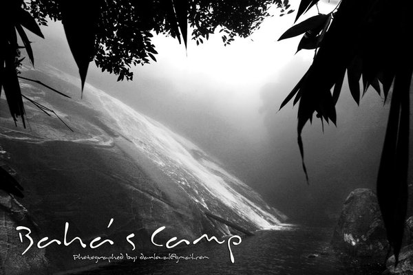
Beautiful camp Tongkat Ali
 
Date: 19 Jan 2008 - 22 Jan 2008
Location: Gunung Chamah, Kelantan
From: Kuala Betis, Gua Musang
Altitude: 2,171m ASL
Difficulty: 7.4/10

Hike duration: 3D/2N
A.K.A.: G5 of Semenanjung Malaysia
A.K.A.: G10 of Malaysia
Camera: Canon EOS 350D
Lens: Sigma 18-200mm F3.5-6.3 DC
Filter: Hoya CPL
Post editing: PS CS2
Organizer: Doreen
Assistant: Kean
Members: Dan, Lucy, KL Tan, Andrew Yeap and CS Law
Guide: 1 orang asli guide from Kuala Betis
My reason to go there: To complete G12, I have to conquer it because it is one of the “G” mountains.

Gunung Chamah is the 5th highest peak in West Malaysia at 2171m in Kelantan, near to Perak's boder
Oraganiser: Doreen
Assistant: Kean

Team members: Dan, Andrew Yeap, Lucy Ng, CS Law, KL Tan
Journey
18 Jan 08
08:30pm – 11:30pm (3 hrs) Butterworth – Kg. Rajah by car

19 Jan 08
07:30am – 09:00am (1.5hrs) Kg. Rajah – Kuala Betis by car
11:00am – 03:00pm (4 hrs) Kuala Betis – Kg. Rekom by 4x4
03:30pm – 06:30pm (3 hrs) Kg. Rekom(900m asl) – Kem Tongkat Ali(1200m asl) – start of hike

20 Jan 08
09:30am – 03:00pm (5.5hrs) Kem Tongkat Ali(1200m asl) – LWP(1900m asl, 5mins down slope) – Summit of Chamah(2171m asl)

21 Jan 08
08:30am – 11:20am (2hrs 50min) Summit of Chamah(2171m asl) – Kem Tongkat Ali(1200m asl)
12:30pm – 02:30pm (2hrs) Kem Tongkat Ali – Kg. Rekom – end of hike
03:15pm – 06:15pm (3hrs) Kg. Rekom – Kuala Betis by 4x4
06:30pm – 07:00pm (30mins) Kuala Betis – Gua Musang by car
08:00pm Dinner

22 Jan 08
10:30am – 12:00pm (1.5hrs) Gua Musang – Cameron Highlands by car
04:00pm - 06:30pm (2.5hrs) Kg. Rajah – Butterworth by car

Rewards of this trip
1. Nice campsite at Kem Tongkat Ali, Sungai Rekom flows beside it.
2. Nice campsite at the summit of Chamah, wide, shady and clean.
3. Good weather on day 1 and day 2.
4. 4x4 able to reach Kg. Rekom despite all obstacles along the muddy balak road
5. No Agas-agas at the summit
6. Really nice hike going up hill and down hill for around 10 times before reaching the summit of Chamah, the trail was clear and nice.
7. No other “kiasu” group to fight for campsite …. (like those at Ulu Sepat, kakaka)
8. 11°C-13°C during the night
8. Nice dinner at Gua Musang

Challenges of this trip
1. Wet balak road causing 4 gruesome hours of 4x4 journey into Kg. Rekom
2. Agas-agas(sand flies) at Kem Tongkat Ali, although not as bad at Ulu Sepat, it is still very irritating.
3. Rain on day 3 for around 2 hrs before ending at Kg Rekom.

Cost
Overall each person spent around RM150.00(driver) + RM80.00(for passenger)

- Guide Fees 3D2N: RM200.00/7pax for 1 Orang Asli guide
- 4WD: from Kuala Betis – Kg. Rekom x 2 ways - RM700.00/7pax

- Entrance fees: NIL
- Camp site fees: NIL
- Permit fees: FOC
- Food: approx. RM20.00/person
- Transport: Passangers AA share petrol + tol cost - Drivers don't pay - RM80.00 each passanger

Summary
I like Chamah, it is still very … hmmm natural. The hike difficulty level is perhaps equivalent to the other G mountains like Ulu.S/YY. I was told that Chamah is the hardest among the G7 mounts (excluding transpex/Merapoh-K.Tahan), but I do not think so now. It is about the same as the others, perhaps even easier.

I believe that when we feel good, we will enjoy the journey, and when we feel bad, even Penang hill will be hard to scale.
So how to feel good? Easy …..
1. Be in tip top physical condition, ample training prior to any big hike is crucial
2. Be mentally prepared, be confident, be vigilant, be independent
3. Do not force to go fast, do not force to go slow. Hike at your own pace, feel happy with your advance
4. Know when to stop, always stop and rest before your body force you to, it would be too late then. Take a break, have a kit kat.
5. Have enough sleep and food and water
6. Keep your feet dry…..

SLIDESHOW